GroundProbe has launched a new data aggregation software for geotechnical sensor monitoring, MonitorIQ. Through the centralisation of all monitoring data into one dashboard and analysis platform, MonitorIQ revolutionises how users consolidate sensor data to correlate and identify trends, ensuring confident decision-making. MonitorIQ is feature-rich allowing users to collate and compare data from more than 120 […]
READ MOREGround-Breaking News – Growth Across Markets and Geographies
As leaders in real-time, geotechnical monitoring of slopes and walls in both open-cut and underground mines, we at GroundProbe have been working in the global mining industry for over 17 years. Over time, we have developed an expert understanding of these environments and their infrastructure – like tailings dams – and the unique challenges they […]
READ MOREGroundProbe Wins Most Innovative Company for Agriculture, Mining and Utilities Sector
GroundProbe has once again been recognised as one of the most innovative companies in Australia and New Zealand, taking out the number one spot on the Agriculture, Mining and Utilities industry list of the Australian Financial Review’s (AFR) Most Innovative Companies for 2019. This comes off the back of last year topping the AFR’s Most […]
READ MOREGroundProbe Attends CIM 2019 Convention and EXPO
GroundProbe recently attended the CIM 2019 Convention and Expo, which was held at the Montreal Convention Centre, in Canada. Attended by over 5,500 delegates from 51 different countries, as well as 450 exhibitors, and 250 guest speakers, the CIM Convention and EXPO is Canada’s premier mining tradeshow. The convention was comprised of a line-up of […]
READ MORERocscience and GroundProbe Launch Two-Way Software Integration
Rocscience and GroundProbe have launched a deep collaboration between their industry-leading software systems, to provide greater value to the global geotechnical community. As part of Rocscience’s new release of their slope stability programmes, Slide3 and RS3, deformation output from any of GroundProbe’s Slope Stability Radars or lasers systems can be imported into these programmes. This […]
READ MOREGroundProbe Attends SME Annual Conference and Expo
Last week, GroundProbe attended the SME Annual Conference and Expo and the CMA 121st National Western Mining Conference in Denver, Colorado. Held at the Colorado Convention Center, from 24th – 27th February, the SME Annual Conference and Expo was attended by over 6000 industry professionals from around the world with the aim of sharing innovative ideas, best practices, […]
READ MOREGroundProbe Hosts User Group in South Africa
GroundProbe’s South Africa office recently held a User Group for their customers with guest speakers from GroundProbe, Orica, Minova, as well as customer sites presenting across a range of insightful and engaging topics. The event was held from the 19th to 22nd February at Mongena Game Lodge, South Africa, and was well attended with 20 […]
READ MORESSR-Omni: Full-Coverage 360° Scans at Long Range
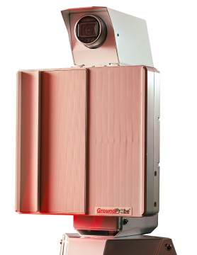
The SSR-Omni features an all-encompassing 360° scan area. It also provides long range scanning at 5.6km, allowing for extensive 11.2km coverage. With geospatial positioning technology built-in, the radar’s location is also automatically georeferenced in SSR-Viewer.
READ MORESSR-Omni: Industry-First 40MP Panoramic Imaging System
The SSR-Omni is equipped with a range of cameras and imaging features unlike any the industry has seen before. Its on-board imaging system is 40 megapixels in resolution, captures a 180° panoramic view in one take and features 21 levels of zoom.
READ MORESlope Stability Radar (SSR) Omni: The Highest Resolution with the Sharpest Definition
The SSR-Omni is ultra-high resolution and ultra-precise. Its fine spatial footprint, defined by its 2.74m aperture baseline, allows its users to easily and confidently locate and distinguish true areas of movement.
READ MORE


