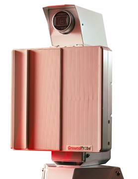
Slope Stability Radar (SSR) at Leinster Nickel Operations

BHP Billiton’s Leinster Nickel Operation (LNO) is located 600km northeast of Perth in the Eastern Goldfields Region of Western Australia.
The mine is set in adverse conditions that required the implementation of a comprehensive Ground Control Management Plan in order to ensure high levels of safety and productivity were met. In particular, the narrow nature of the pit also created a high consequence potential that needed to be managed.
LNO included two Slope Stability Radar (SSR) systems in its plan to ensure that the most critical areas of the pit were continuously being monitored in real-time. In particular, the systems were used to monitor areas where there was a low level of confidence in the ability of prisms and visual inspections to predict failure with adequate time to remove all personnel and equipment.
The first SSR was first deployed at Harmony Pit in October 2002. The initial focus of the system was to monitor an area where a major failure indicated the potential closure of the mine. A second SSR was added in 2003.
The real-time ability of the SSR to show when to safely suspend and re-initialise operations gave the operation immense confidence as it progressed into this critical stage of mining.
The data example above shows how the SSR provided LNO approximately 12 hours of warning prior to this failure.
In another instance, where installing prisms on the batter face of a wall was considered too risky, the SSR was used to continuously scan the area while work progressed.
The application of the SSR systems enabled Harmony Pit to continue mining for months following the indication of the major failure and highlights the importance of a critical realtime monitoring tool as part of a comprehensive monitoring program.


