GroundProbe Partners with NavStar to Offer GeoExplorer 6

GroundProbe has announced a partnership with NavStar, a specialist developer and market leader of geotechnical data aggregation software and systems, to give GroundProbe customers access to their intuitive GeoExplorer 6 data integration platform and the accompanying GroundProbe module.
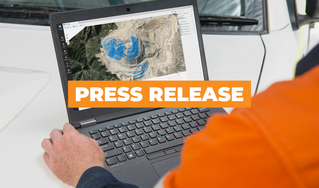
GeoExplorer enables data from a wide range of monitoring sensors to be viewed on the same maps, dashboards and charts, allowing users to cross-analyse what their different sensors are saying about slope conditions.
The versatile software platform can integrate data from an extensive range of slope stability monitoring hardware including radar, GPS, laser, satellite InSAR, total stations, piezometers, accelerometers, and many more, eliminating the need to run multiple software programmes that don’t speak to each other.
“Of huge benefit, displacement data can be viewed on the same time scale and with the same colour palette via a heat map, where ‘hot’ colours represent movement,” said Lachlan Campbell, GroundProbe’s VP of Marketing and Technology.
“Furthermore, it has powerful reporting, with drag and drop features to customise reports that unify all sensors. Those reports can then be run at the end of every shift, day, week, month or any reporting period selected by the user.”
Since 2008, NavStar has been providing monitoring solutions to clients around the world. With products that are designed to improve safety and productivity, NavStar were a natural fit for GroundProbe to partner with.
“NavStar has gained an excellent reputation with their customers from a proven track record of delivery,” said Mr Campbell.
“As leaders in their field, it made sense for us to leverage from their experience and expertise and allow our customers to access their tried and tested GeoExplorer software.”
Through the GroundProbe module, GeoExplorer seamlessly syncs with GroundProbe’s own slope monitoring software solution, SSR-Viewer 8.4, to offer users a range of benefits when assessing data from their Slope Stability Radars.
“GeoExplorer 6 provides the ability to view data from multiple radars, either live or for back analysis, on the one dashboard. Live data can be viewed, scan by scan, and alarms generated by SSR-Viewer are raised live in GeoExplorer,” said James Usherwood, GroundProbe’s Product Development Manager.
GeoExplorer also supports multi-user functionality meaning it can be run simultaneously by multiple users both on and off site.
“In order to ensure all users are getting the most up-to-date data at all times, changes are made in real time and reflected for all users; optimising the decision-making process,” said Mr Usherwood.
Glen Bjorgan, NavStar’s founder, spoke of the importance of designing the GeoExplorer platform with a top-down approach by starting with the big picture and breaking it down into smaller components, combining a highly-regarded user interface with powerful capabilities.
“We make every effort to think from the user’s perspective and to keep the software as simple as possible, leaving complex tasks behind the scenes,” Mr Bjorgan explained.
“Our dedicated team of software developers aimed to simplify the integration of many slope monitoring systems into a single platform. The result is an advanced, flexible, high-performance solution.”
GroundProbe recently launched SSR-Viewer 8.4, an initiative update to their SSR-Viewer software platform. Its new features, together with the availability of NavStar’s GeoExplorer platform, continue to allow their customers to make time-critical decisions vital to profitability and the safety of their employees.


